Blog Tools
Edit your Blog
Build a Blog
View Profile
19 Mar, 07 > 25 Mar, 07
12 Mar, 07 > 18 Mar, 07
5 Mar, 07 > 11 Mar, 07
26 Feb, 07 > 4 Mar, 07
19 Feb, 07 > 25 Feb, 07
12 Feb, 07 > 18 Feb, 07
5 Feb, 07 > 11 Feb, 07
29 Jan, 07 > 4 Feb, 07
22 Jan, 07 > 28 Jan, 07
15 Jan, 07 > 21 Jan, 07
14 Mar, 05 > 20 Mar, 05
7 Mar, 05 > 13 Mar, 05
28 Feb, 05 > 6 Mar, 05
21 Feb, 05 > 27 Feb, 05
14 Feb, 05 > 20 Feb, 05
7 Feb, 05 > 13 Feb, 05
31 Jan, 05 > 6 Feb, 05
24 Jan, 05 > 30 Jan, 05
17 Jan, 05 > 23 Jan, 05
10 Jan, 05 > 16 Jan, 05
20 Dec, 04 > 26 Dec, 04
29 Nov, 04 > 5 Dec, 04
31 Dec, 01 > 6 Jan, 02
You are not logged in. Log in
Entries by Topic
All topics  «
Edwins Bicycle Tour Downunder
Tuesday, 16 January 2007
Sunday 14 January, Flying over Sumatra


remote Posted by Edwin at 7:41 AM EADT
Post Comment | Permalink
Saturday 13 January to Sunday 14 January. Flight to Melbourne.

The flight was from Heathrow Terminal 3 to Singapore and then after a few hours in transit a change to another plane for the onward flight to Melbourne.

Departure was 11.00am Saturday but we all arrived by 7.00 Those on the trip are myself, Edwin, Martin Greening from Dorset, Peter Tindley from Dorset, (Peter T) and Peter Wilson from Arun Adur CTC in Sussex (Peter W) We were soon checked in.

We flew with Singapore Airlines and were welcomed onboard by pretty Stewardesses in long Asian dresses. We flew over Europe with a sheet of cloud covering the Continent. Sunset arrived early as we flew East. We flew in the dark just north of Iran with lights of Iranian towns visible. Then over Afghanistan! Parkinstan and India and down to Singapore.

We had 3 hours and a change of planes in Singapore with time for a shower to freshen up at one of the Transit Hotels.

On the way to the plane a ladies luggage fell over at the exit to the moving walkway which I managed to step around quickly but others started to pile into and Peter T and Martin had to walk backwards on the walkway with looks of gathering panic on their faces. The blockage was soon cleared.

We got on another Singapore Airways Plane to Melbourne and our 3rd breakfast in 24 hours. We crossed the Equator and over Sumatra and over 1000s of miles of the barren interior of Australia and then right over the centre of Adelaide and on to Melbourne. We easily got a minibus sized taxi with room for us and all the Bikes and on to the Hotel.

The flight from London to Singapore was 12 hours followed by 3 hours in transit and a 7 hour flight to Melbourne so 22 hours total.

Edwin


remote Posted by Edwin at 7:35 AM EADT
Post Comment | Permalink
Saturday, 13 January 2007
Australia 2007 Itinery

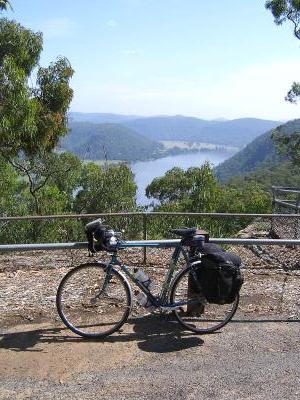
Below is the Itinery for a planned cycle tour of South East Australia riding from Melbourne to Adelaide through the interior and then back to Melbourne on the coast including the Great Ocean Road.

Over the next 2 months write-ups and pictures will be posted on this Blog using a handheld Computer with mobile Internet connection

Sat 13 Jan Fly out from London. 11.00am London Heathrow

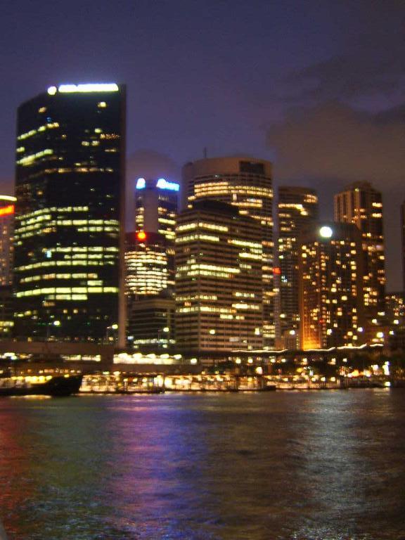
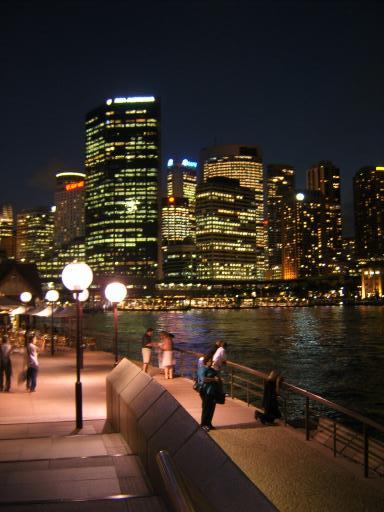
Sun 14 Jan Arrive Melbourne 20.10 and taxi to the Hotel.
Stay Miami Hotel, 13 Hawke Street, Melbourne.
Web - www.themiami.com.au
1 room with 4 beds
Note we return here at the end of the trip and they have agreed to store boxes or packing material for us.


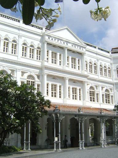
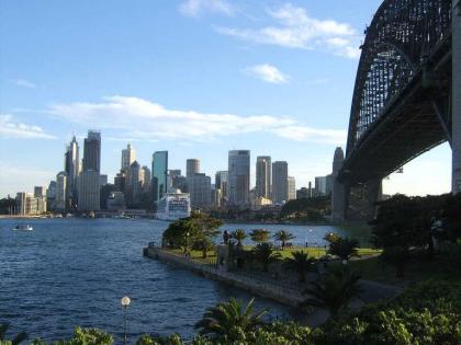
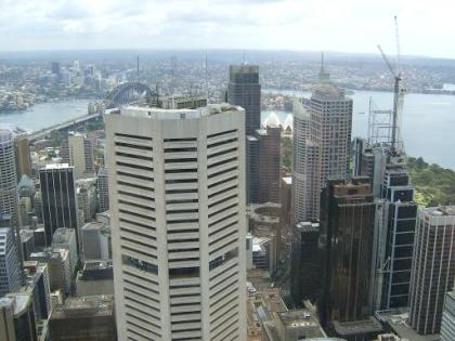
Mon 15 Jan Melbourne Rest Day
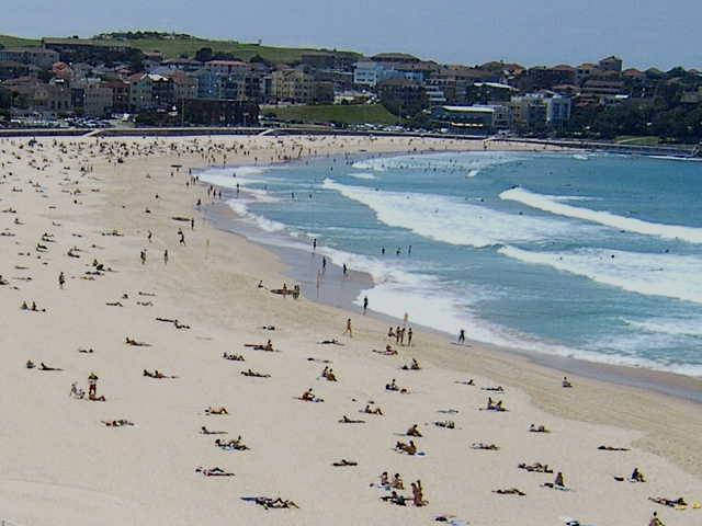
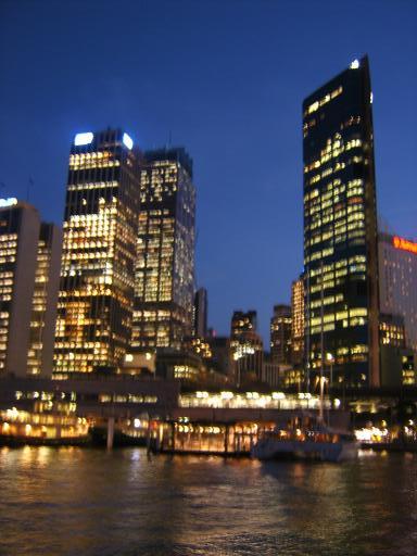
Explore the city.


Tues 16 Jan Melbourne to Ballarat 50 miles)
Take a suburban train north to Baccus Marsh. And then back roads through the goldfields area to Ballarat
Stay Best Western Barkly Motor Lodge, 43-57 Main Street,
Ballarat. 2 Twin bedded rooms.
Tel 03 5331 8838.

Weds 17 Jan Ballarat to Maryborough (42 miles)
Head northwest still in the gently rolling countryside of the goldfields. 2 twin bedded rooms.
Stay Bristol Hill Motor Inn, I High Street, Maryborough,
Tel 03 5461 3833.
Web - www.bristolhill.com.au

Thurs 18 Jan Maryborough to Ararat (55 miles)
Head west stopping just short of the Grampian Mountains.
Stay Best Western Statesman, 79 Lambert Street, Ararat.
2 twin bedded rooms.
Tel 03 5352 4111
Web - www.bestwestern.com

Fri 19 Jan Ararat to Halls Gap (29 miles)
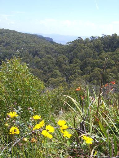
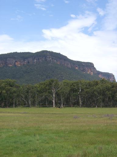
Ride into the Grampian Mountains and Grampian National Park. Some climbs up to 1300ft.
Stay Best Western Halls Gap Colonial Motor Inn, Grampians Road, Halls Gap. Includes breakfast.
2 twin rooms including Spar Pools in the rooms.
Tel 03 5356 4344

Sat 20 Jan Halls Gap (Rest Day)
Optional ride in the Grampians area


Sun 21 Jan Halls Gap to Horsham (48 miles)
Head down from the Grampians and along to the Australian version of Horsham.
Stay Best Western Golden Grain Motor Inn, 6 Dimboola
Road, Horsham. 2 Twin bedded rooms.
Tel 03 5382 4741
Note Peter stays tomorrow night in Horsham and then Tuesday gets the Train to Adelaide and we meet up again when the rest of us get to Adelaide on 29 January


Mon 22 Jan Horsham to Nhill (51 miles)
Head west from Horsham and then north and into serious outback as we cross the Little Desert National Park.
Stay Comfort Inn Zero, 31 Nelson Street, Nhill. I room with 3 beds.
Tel 03 5391 1622

Tues 23 Jan Nhil to Warracknabeal (61 miles)
Ride north of the Little Desert into Wheatfield plains.
Stay Warrack Motel, 2 Lyle Street, Warracknabeal.
1 twin room and 1 single.
Tel 03 5398 1633. No Web

Weds 24 Jan Warracknabeal to Ouyen (95 miles)
Early start today with probably high temperatures and a strong prevailing headwind.
Take backroads north across the plains.
Stay Malle Motel, Hughes Street, Ouyen. Twin room and single room.
Tel 03 5092 2195. No Web.


Thurs 25 Jan Ouyen to Mildura (63 miles)
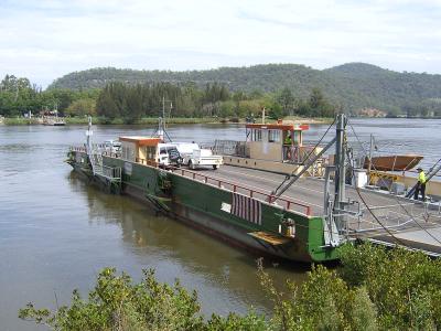
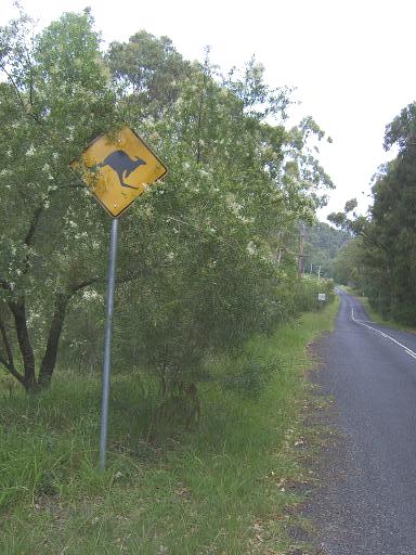
Head further north across Hattah Kulkyhe National Park home to a large wild Kangaroo population and more outback to the Murray River Valley
Stay 7th Street Motel, 153 7th Street, Mildura. 1 room 3 beds
Tel 61 3 5023 1796.

Fri 26 Jan Mildura – Rest Day
Explore the town. Possibly a short ride north across the border into New South Wales or a River Boat Trip.

Sat 27 Jan Mildura to Renmark (87 miles)
Some back-roads and then main road due West across the border into South Australia. Early start.
Stay Renmark Hotel, Murrey Avenue, Renmark.
2 room suite with 3 beds.
Tel 08 8586 6755

Sun 28 Jan Renmark to Swan Reach (78 miles)
Head south alongside the Murray River National Park and then west on a byroad to Swan Reach. Early start.
Stay Swan Reach Hotel, Swan Reach.
I twin room and 1 single.
Tel 08 8570 2003

Mon 29 Jan Swan Reach to Adelaide (87 miles)
Take backroads and then a main road to the City. Early start
Stay Mercure Grosvenor Hotel, 125 North Terrace, Adelaide. 2 twin rooms.
Tel 08 8407 8888
 

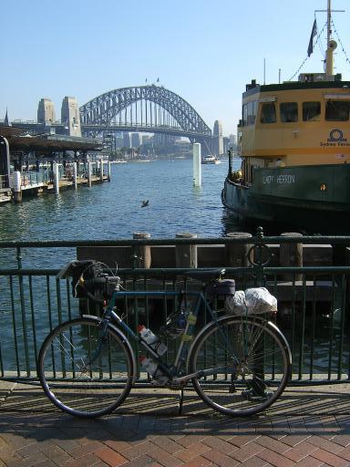
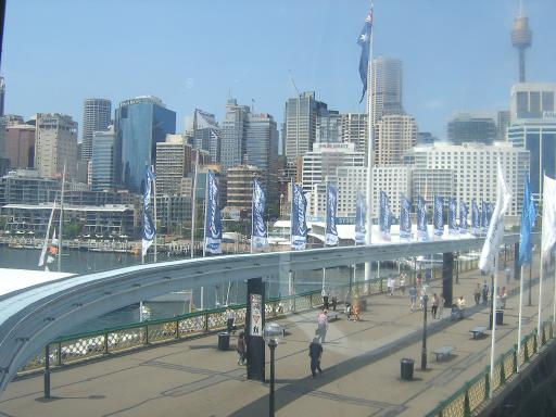
Tues 30 Jan Adelaide (Rest Day)
Time to explore the City which is very bike friendly with lots of Bike paths


Weds 31 Jan Adelaide to McLaren Vale (26 miles)
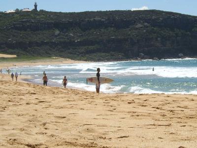
Head south out of the City on a bike path and then further south into the scenic Fleurieu Peninsular. Time for a beach stop in the afternoon. Note we stop short of our originally planned destination of Willunga due to a lack of hotels.
Stay McLaren Vale Motel, Main Road, McLaren Vale.
2 room unit, 4 beds.


Thurs 1 Feb McLaren Vale to Victor Harbor (47 miles)
South on a coastal backroad to Normanville and then SE across the peninsular along the Inman Valley to Victor Harbor.
Stay Anchorage Seafront Hotel, Victor Harbor.
2 Twin bedded rooms
Tel 08 8552 5970

Fri 2 Feb Victor Harbor to Tailem Bend (67 miles)
Follow a Cycle trail along the coast to Goolwa and then north to Tailem Bend. Note we have to go much further than first planned due to a lack of accommodation at the original destination of Strathalbyn. Shorter distance tomorrow
Stay Motel River Bend, Princes Highway, Tailem Bend.
2 twin bedded rooms.
Tel 08 8572 3633. No Web


Sat 3 Feb Strathalbyn to Magrath Flats (48 miles)
Head SE on the Princes Highway down to the Coorong National Park a series of lagoons next to the coast. Stay at the Coorong Wilderness Lodge which is run by the local Aboriginal Community. 1 room, 2 bunk beds and 2 singles.
Tel 08 8575 6001
 

Sun 4 Feb Magrath Flat to Kingston SE (69 miles)
Follow the main road alongside the Coorong National Park lagoons. Stay at Lacepede Bay Motel, Kingston SE.
2 twin bedded rooms
Tel 08 8767 2444

Mon 5 Feb Kingston SE to Beachport (54 miles)
Follow the Southern Ports Highway down the coast to the quiet seaside resort of Beachport.
Stay Beachport Motor Inn, Railway Terrace, Beachport.
2 Twin bedded rooms.
Tel 08 8735 8070

Tues 6 Feb Beachport to Mt Gambia (47 miles)
Follow the main road south east to the town of Mt Gambia built on the slopes of an extinct Volcano. Note we stay here 2 nights instead of at Portland as originally planned as this looks to be a more interesting town than Portland.
Stay at Avalon Motel, 93 Gray Street, Mt Gambia.
Stay in a 4 bedroom apartment.
Tel (08) 8725 7200

Weds 7 Feb Mt Gambia (Rest Day)
Visit points of interest round the town including thermal lakes and Caves.


Thurs 8 Feb Mt Gambia to Portland (67 miles)
Cross the border back into Victoria and follow a B road near the Coast and through National Parks.
Stay Victoria Lodge Motor Inn, 155 Percy Street, Portland.
One 2 bedroom Apartment. Queen bed in 1 room, 2 beds in the other room and Sofa bed in the lounge. Note - Washing machine and Dryer in the Apartment.
Tel 03 5523 5966

Fri 9 Feb Portland to Warnambool (62 miles).
Follow the main road around Portland Bay.
Stay at Redwood Manor Motel Apartments, 251 - 253 Koroit Street, Warrnambool. 2 Twin bedded rooms.
Tel 03 5562 3939

Sat 10 Feb Warnambool to Port Campbell (38 miles)
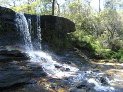
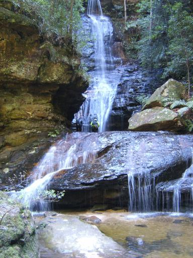
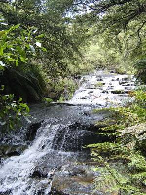
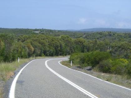
On this day we turn off the main road for the start of the Great Ocean Road. We spend 5 days riding this road which is famed for its spectacular clifftop views, fine bays and coves and eroded rocks. With a lot of accommodation available, mileages can be kept low to give time for side trips and to view the scenery.
Today we get the first coast views halfway into the ride.
Stay Best Western Great Ocean Road Inn, 10 Great Ocean Road, Port Campbell. 2 room suite, 4 beds
Tel 03 5598 6522

Sun 11 Feb Port Campbell to Lavers Hill (31 miles)
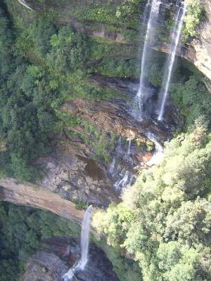
Cliff road through Port Campbell National Park. View the eroded outcropping of the 12 Apostles offshore rocks. In the afternoon a long climb to Lavers Hill at 1500ft
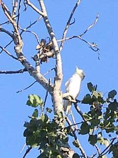
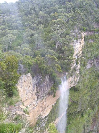
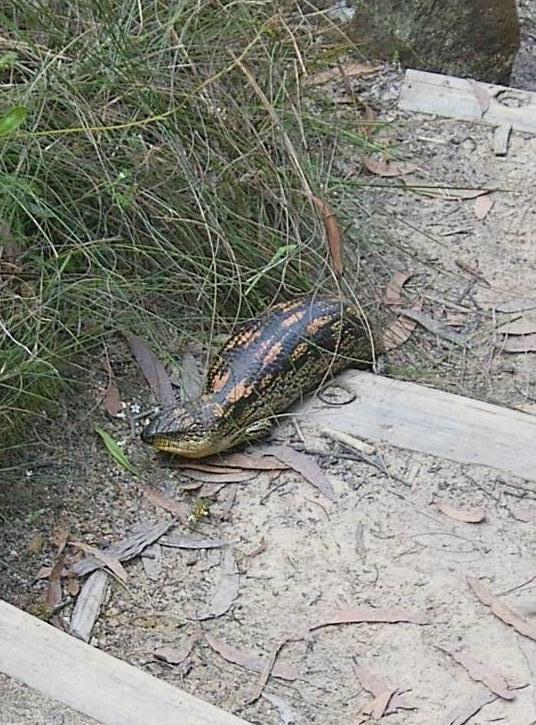
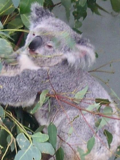
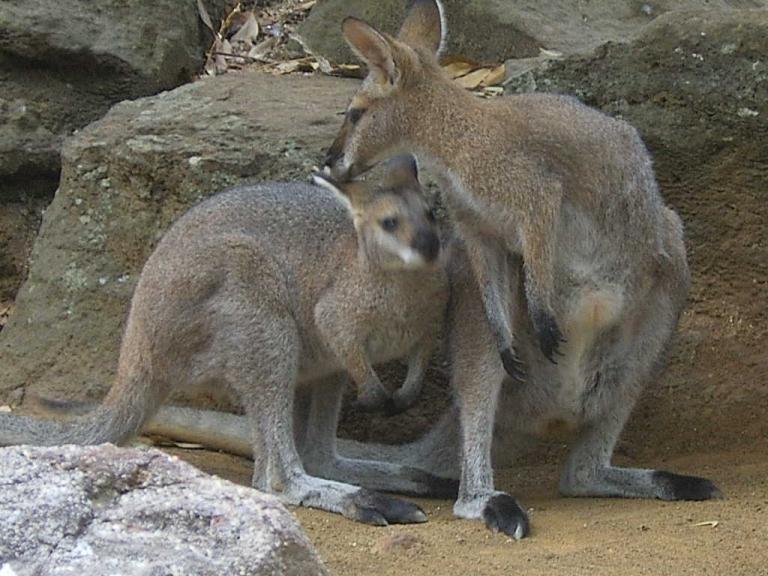
Stay at Fauna Australia a small private wildlife reserve a mile from Lavers Hill. Stay at the Kangaroo Unit which has a double bed 2 singles and a sofa bed and bunk bed. Take a special look at the Website on this. The chance to see a lot of wild animals could make this a highlight of the trip.
Tel 03 5237 3234

Mon 12 Feb Lavers Hill to Apollo Bay (30 miles)
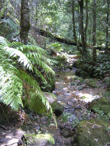
A long descent from Lavers Hill followed by the flat floodplain of the Calder River and then a long climb through the Otway National Park. Stop at the Maits Rest Boardwalk rainforest walk. Then a long descent to Apollo Bay. There are no shops or cafes on the route today so we will need to carry food.
Stay at Comfort Inn The International, 37 Great Ocean Road, Apollo Bay. 3 bed family unit and 1 single room.
Tel 03 5237 6100

Tues 13 Feb Apollo Bay to Lorne (28 miles)
This is the most spectacular section of the Great Ocean Road, where the route is carved into the cliffs as they plunge into the sea.
Stay at the Sandridge Motel, 128 Mountjoy Parade, Lorne.
Two twin bedded rooms
Tel 03 5289 2180

Weds 14 Feb Lorne to Geelong and train to Melbourne (44 miles)
Along the coast to Torquay and then north to Geelong. Catch a late afternoon train to Melbourne. There are frequent VLine suburban trains which take bikes.
Stay Miami Hotel, 13 Hawke Street, Melbourne.
Web - www.themiami.com.au
1 room with 4 beds

Thurs 15 Feb Melbourne (Rest Day)
Possibly take the bikes on a train to explore one of the National Parks to the East.


Fri 16 Feb Melbourne (Rest Day)
Pack the bikes and explore the City. Note- This night is booked so we can have use of the room as long as possible before leaving to get the flight


Sat 17 Feb 3 of the group Fly back. 00.50

Edwin stays on for another 3 and a half weeks


remote Posted by Edwin at 1:16 AM EADT
Updated: Saturday, 13 January 2007 1:56 AM EADT
Post Comment | Permalink
Saturday, 12 March 2005
Singapore, Friday 11 March.


1) Sri Mariamman Hindu Temple in Chinatown

2) Thian Hock Keng Temple

3) View of street in Chinatown

4) Riverside walk


I had near enough another full day in Singapore before getting the 22.40 flight to London. Weather was again hot and humid reaching 33C.

The early part of the morning was spent packing and leaving the luggage with the Hotel. I then used the MRT underground system to head down to Chinatown near the City Centre. The rest of the morning was spent visiting some impressive temples. As chance would have it the first temple I came to wasn't Chinese but Hindu, the Sri Mariamman Temple. This has many impressive carvings of figures and sacred cows and a services was in progress

Next it was on to Thian Hock Keng Temple with much gold leaf, pagodas and dragon figures. Finally it was on to the Wak Hai Cheng Bio temple with collections of miniature figurines carved on the temple roof.

It is notable that Chinatown is on the edge of and is very much overshadowed by the towers of the Financial District. Another interesting point in picture 3 is that many Singapore ladies carry umbrellas as shelter from the tropical sun.

An afternoon break was spent at Boat Quay, a series of restaurants on the riverfront below the Financial District. I then took a pleasant riverside walk to the Esplanade. This has underpasses under the roads and bridges which avoids the big problem with visiting cities of crossing busy urban roads.

I returned to the hotel in time for the pre-booked Maxi-Taxi pickup to take me and the bike to the Airport.

Check-in wasn't as smooth as last time. After weighing bike and luggage I was told there would be an excess baggage charge of over 400 Singapore Dollars or about 140 pounds. I avoided this by untying the 2 panniers and keeping one pannier as hand luggage which brought checked baggage below the limit.

The flight back from Singapore was 13 1/2 hours - back to reality and some adjusting to do to a very cold 8C back in the UK.


The end of the trip, so some statistics for you. Total distance on the bike for the 9 weeks of the trip was 1784 miles. Total feet of climb for the trip recorded on the cyclo altimeter/Bike Computer was 89,398ft.

56 rolls of 36 exp slide film were taken and 2362 digital pictures.

Counting each take off and landing as a separate flight when a journey involved stops there were 9 flights on the round the world air trip

remote Posted by Edwin at 8:19 PM EADT
Updated: Friday, 22 April 2005 4:11 AM NZT
Post Comment | Permalink
Singapore, Thursday 10 March


1) View from Suntec Tower

2) Duck Tour

3) View from the Sky Tower of the cable cars coming into Sentosa Island

4) Evening view of the river and financial district from Elgin Bridge


Today was more exploration of Singapore, on foot or using the MRT, the City's underground system. Weather was sunny to start with getting cloudier and temperature up to 33C and very humid. I have no complaints about excessive heat and want to make the most of it before returning home to a frigid 8C in a few days.

My first destination was Suntec City, a complex of 4 skyscraper blocks of offices and shops. Tower 4 has a Summit Tour to take in the view from the top. There are good views looking towards the Bay and the Financial District.

After lunch in the Tower I took in a "Duck Tour" This is a tour of parts of the City and harbour on an amphibian vehicle.

Next I followed the signs for the City Hall MRT underground Station and ended up in the City Link Mall. This is a good 1/2 mile of underground air-conditioned shopping mall linking Suntec City with the City Hall area.

I took the MRT to Harbour Station in the far south of Singapore Island and then took the Cable Car ride to Sentosa Island. There is a narrow straight between Singapore and Sentosa crossed by a bridge and cable car. The Island is a leisure retreat with beaches forests and Tourist attractions. I took a ride on the 110 metre Sky tower.This does not have a fixed viewing area at the top but is an observation ride rotating as it goes to the top and then back down.

I took a nature walk through tropical rainforest before returning on the cablecar. After an early dinner at a riverside restaurant I took more evening photos of the City.


remote Posted by Edwin at 8:10 PM EADT
Updated: Friday, 22 April 2005 4:17 AM NZT
Post Comment | Permalink
Thursday, 10 March 2005
Singapore, Wednesday 9 March


1) Raffles Hotel

2) The Long Bar at Raffles.

3) The Financial District from the Riverside.

4) Evening View of the financial District from the Bay Esplanade

5 Night view of the financial District from the riverside


My hotel room is on floor 19 so I had a great view over the City. Weather was hot humid and sunny with patchy cloud and temperature getting to 31C. It was notable that in most places the default for Air Conditioning is off but here when the room key is taken out of the slot cutting power for the lights the Air Conditioning automatically comes on.

I set off to explore, walking through the alleys of Little India to the South of the Hotel and eventually making my way to the Raffles Hotel.

The middle of the hotel including the Hotel Lobby is off limits to non guests but anyone is free to wander the courtyards and go to the shops and museum. I finished my visit with a hot Chocolate at the famous Raffles Long Bar. This cost about 3 pounds but was worth it for the ambience and I kept the bill as a souvenir .

I next headed past the Singapore Cricket Club to the river and got on a river trip which leave from various Warf's every 15 minutes. This was a great introduction to the City.

I had lunch at a riverside restaurant before heading across the river to the Financial District with its great conglomeration of Skyscrapers. The centre of all the Skyscrapers is Raffles Place Shopping Centre (not connected with the hotel) and I stopped at a cafe there for an air conditioned afternoon break.

I next explored a walkway on the other side of the river estuary and bay from the Financial district. This goes past the "Esplanade Theatres on the Bay" which is a new building looking a little like 2 giant hedgehogs. I returned here after a quick meal for sunset and twilight pictures of the financial district and later took night pictures from the riverside.

remote Posted by Edwin at 1:15 PM EADT
Updated: Saturday, 23 April 2005 7:37 AM NZT
Post Comment | Permalink
Sydney to Singapore, Tuesday 8 March


1) Taking off from Sydney flying over Cronulla Beach near Botany Bay

2) Outback river systems

3) Rocky ridges in the Desert

4) Great Western Desert


The flight to Singapore will be at 5.00 p.m. After checking out of the room I set about dismantling and boxing the bike in the rear courtyard of the B&B.

I ordered an estate car taxi which turned up on time at 1.00 p.m.. Check in this time was quick and easy with no excess baggage charges and a 40 kilo allowance for longer flights. I also got a window seat for the flight across Australia.

This time I got a 27 hour day with Singapore being 3 hours behind Sydney time. This also meant that sunset was delayed to 9.00pm Sydney time. The route went north west across Australia for 2000 miles across the Blue Mountains, outback and desert. With clear skies most of the way this provided lots of picture opportunities.

The flight was 7 1/4 hours. Singapore Airport was cleaming and effecient. If you go be sure to pick up the very good free map of the City from the Information Stand on the way to baggage reclaim.

The bike was easy to get to the hotel with a stand for Maxi-Taxis, small minibus size. I will be staying for 3 nights at the New Park Hotel a 21 storey block on the northern edge of the City Centre. I will not be using the bike and the Hotel Porter put it out of the way in the hotels luggage store.


remote Posted by Edwin at 1:09 PM EADT
Updated: Saturday, 23 April 2005 7:41 AM NZT
Post Comment | Permalink
Sydney, Monday 7 March.


1) Parakeets having breakfast

2) Manley Beach

3) The Opera House and the Harbour from the Bridge walkway

4) The Harbour and bridge from Milsons Point

5) The Harbour Bridge in twilight

6) Circular Quay


Today was a fairly lazy off the Bike day. There was some entertainment at breakfast when the B&B Lady fed the Parakeets which are resident in the trees at the back of the B&B.

I took the ferry to the centre and then another ferry out to visit Manley again and do some sunbathing. The temperature was again a little cooler than it had been at 25C but with cloudless blue skies.

The late afternoon was a little more active. After taking the ferry back to the centre I found the steps to the walkway across Sydney Harbour bridge. This has great views looking down on the Harbour and the Opera House. The walk is best done in the late afternoon with the Sun shining from behind the bridge. Many Sydney residents seemed to use the bridge walkway to jog or walk back from work.

On the other side I took in the views of the bridge from Milsons Point. After returning to Circular Quay I took more twilight pics of the City against the darkening blue skies.

remote Posted by Edwin at 1:04 PM EADT
Updated: Saturday, 23 April 2005 7:47 AM NZT
Post Comment | Permalink
Monday, 7 March 2005
Wyong to Sydney, Sunday 6 March.


1) Ettalong Harbour

2) Palm Beach

3) Surfer at Palm Beach

4) Back in Sydney, on the ferry back to Cremorne Point


Today's ride was to follow the coast south to Sydney with a ferry across the estuary of the Hawkesbury River and then near Sidney's northern beaches to Manley at the entrance to Sydney Harbour and a ferry to the centre

The frontal rain of yesterday had brought much cooler air through and it only got to 23C but with crystal clear blue skies.

I found byroads to skirt the edge of the town of Gosford and then down to Ettalong alongside Ettalong Harbour. The ferry goes from Ettalong to Palm Beach the most northern of Sydney's beaches. I stopped here for a picnic lunch and some sunbathing. I took a pleasant byroad south from Palm beach which follows the coast but with a lot of climbing.

Eventually the only way south was on a busy main road. However on long sections of this there were 3 lanes with the inner lane not used by traffic providing a good bike route.

From Manley I took the ferry to the centre and then another ferry out to the B&B Cremnorne Point Manor.

Distance for the day was 44 miles with 1860ft of climb.

remote Posted by Edwin at 3:12 PM EADT
Updated: Monday, 7 March 2005 3:48 PM EADT
Post Comment | Permalink
Windsor to Wyong, Saturday 5 March


1) Hawkesbury River above Wisemans Ferry

2) Wisemans Chain Ferry

3) Local wildlife pictured in the Yarramalong valley


Windsor is west of Sydney. Today's ride looped a long way north to Wyong on the coast 60 miles to the north of Sydney. I took the route from a listing of rides near Sydney on the Internet. Part of the route involved using a minor road and a chain ferry across the river. I did some research on the Internet the previous night to confirm this was still running.

The forcast had been for rain all day but luckily this was delayed to the afternoon. The day started hot humid and sunny with temperatures getting to 33C before the rain arrived.

The big advantage of taking roads which depend on ferries is that traffic tends to be much lighter. I headed north on a byroad to Sackville and then a chain Ferry to Sackville North. Then a byroad climbing to a ridge and a main road still relatively quiet to cross the river again at Wisemans Ferry. Both the ferries are free presumably provided by local authorities.

I stopped for elevenses at a cafe in the town of Wisemans Ferry and got supplies for later.

On the other side of the ferry the road runs along the banks of the Hawkesbury River and on the edge of the Dharug National Park. The road is marked as a main road but is really quiet. The rain started about 1.00 and continued fairly light for 4 hours before clearing to blue skies again.

I had noticed on the Map that there was a Mangrove Lower and a Mangrove Mountain and guessed there might be a climb in-between. This proved to be about 1000ft. After a stop for tea at Mangrove Mountain I descended on more quiet roads and down Bumble Bee Hill to the Yarramalong valley and a pleasant byroad down to Wyong.

Distance for the day was 76.8 miles with 3503ft of climb and a riding time of 7hrs 35mins

remote Posted by Edwin at 3:03 PM EADT
Updated: Tuesday, 8 March 2005 3:28 PM EADT
Post Comment | Permalink
Katoomba to Windsor, Friday 4 March.


Picture of the Katoomba Ridge from Highway 40


Today it was time to move on. I decided to avoid the dangers of the Great Western Highway and catch a train for 15 miles to Fort Victoria. Weather was hot and sunny eventually getting to 31C.

I stocked up with some food at Fort Victoria as the ride is through remote areas for some distance. Rather than going back the way I came into the Blue Mountains the route loops round to the north before dropping down east to Windsor on the Hawkesbury River.

I first took a quiet road called the Darling Causeway. This keeps to the ridge of the Blue Mountains but with many ups and downs. Then I joined Highway 40 heading east. At one point it loops within 10 miles of the other ridge with the Great Western Highway and Katoomba.

I stopped for lunch at Mount Tomah Botanical Gardens Restaurant after a steep climb near Mount Tomah. The Gardens were the edge of the Blue Mountains with the road loosing a lot of height. Soon after the descent I turned off on a minor road to come into Windsor from the north. I managed to avoid the thunderstorms again which rumbled around late afternoon.

Windsor is an old town by Australian standards on the banks of the Hawkesbury river which is the main river draining from the Blue Mountains.

Distance for the day was 52 miles with 2752ft of climb.

remote Posted by Edwin at 2:53 PM EADT
Updated: Monday, 7 March 2005 3:36 PM EADT
Post Comment | Permalink
Katoomba, Megalong Valley, Thursday 3 March.


1) Looking towards the Megalong Valley from the Ridge.

2) Coachwood Glen.

3) Edge of the Rainforest

4) Warning - Kangaroos crossing


The day started misty and drizzly so in the early part of the morning I went along to an Internet Cafe to update the Blog Website and check my bank accounts.

The sun came out mid morning with temperatures rising to 23C. I had decided to do more of a bike ride today after all the walking of the last few days. I first rode up to Blackheath again and stopped there for lunch

Next I headed down the Megalong Valley Road. This is a quiet dead-end valley road which plummet's down from the plateau through rainforest to a few areas of farmland near the small village of Megalong. The descent, and climb back up later is 1500ft.

The road descends steeply under a thick canopy of rainforest with the cliffs of the plateau towering above. Partway down I stopped at the Coachwood Glen Nature walk. This is a 30 minute circular walk through rainforest. I saw a parrot on entering the path but it flew off to a higher canopy before I could get a picture.

I continued on down to the valley and saw several signs warning of Kangaroos. These were genuine road signs not joke signs and the valley is well known for them. I looked but didn't spot any, which is perhaps not surprising as judging from Sidney Zoo they spend most of the middle part of the day snoozing under a bush.

I turned back at Megalong village where the road turned to gravel. On the way back I stopped at Megalong Tearooms for Hot Chocolate and Apple Pie on their Veranda.

Late afternoon thunderstorms were again building and rumbling around the hills. I nervously noted the many lightning damaged trees as I cycled back up under the thick canopy of the rainforest. Luckily the lightning and the rain stayed in the distance.

The plateau top had become shrouded in mist and I decided to get a train from Blackheath back to Katoomba. That section of the Great Western Highway is narrow in places with the hard shoulder sometimes disappearing and lots of lorries thundering by.

Ride for the day was 26.2 miles with 2338ft of climb and a riding time of 2hrs 51mins.

remote Posted by Edwin at 2:42 PM EADT
Updated: Saturday, 23 April 2005 11:18 PM NZT
Post Comment | Permalink
Thursday, 3 March 2005
Katoomba, Waterfalls snakes and Lizards, Wednesday 2 March.


1) View from near Govetts Leap Lookout.

2) Horseshoe Falls

3) Govetts Leap Falls with spray blown upwards.

4) Lizard on steps down to falls


Today's ride was 8 miles north west further into the Blue Mountains to Blackheath and various walks from Govetts Leap Lookout. The weather for the morning was hot humid and sunny getting to 28C.

The view from Govetts Leap Lookout is outstanding with cliffs falling away to extensive Rainforest and views of waterfalls.

My first walk was on a quite difficult track down and round to the Twin Falls Viewpoint. This gives views of the nearby Horseshoe falls where the water plummets down into mist and rainbows and the more distant Govetts Leap falls. I returned the way I came to Govetts Leap Lookout. I saw 3 people on the entire walk which took about 1 1/2 hours. Most people arrive in coaches at the main lookouts and then leave.

After returning to Govetts Leap Lookout I headed off in the other direction on an easier track to Govetts Leap Falls.

Near to the falls I stopped and beat a hasty retreat on spotting a large reptillian head on the steps. The way it was lying the legs were hidden and as can be seen from the photograh it looked like the front part of a large snake. When it moved the legs became visible and it was clearly a large lizard. The Visitor Centre Staff later identified it from the photo as a Blotched Bluetongue Lizard. It stayed on the steps for several minutes long enough to take several pictures from a distance. The photo is with zoom and digital enlargement.

After the Lizard moved off I continued down to the falls. The wind was picking up and blowing water upwards from the falls in a fine spray

As I rode back the weather was quickly changing and a thunderstorm gathered. I was about half way back when the first heavy spots started to fall and I took refuge in a bus shelter for 40 mins of torrential downpour including hail.

Cycling distance was 17.6 miles with 1233ft of climbing and riding time of 1hr 44mins.

remote Posted by Edwin at 10:12 AM EADT
Updated: Saturday, 23 April 2005 11:22 PM NZT
Post Comment | Permalink
Katoomba,Wentworth Falls, Tuesday 1 March


1) Wentworth Falls

2) Queens Cascade

3) Empress Falls

4) Three Sisters


Today was a really good day with cloudless blue skies and temperatures getting to 26C. As with yesterday I used the bike to get to points of interest but much more of the day was spent walking up and down tracks than cycling.

My destination of the day was Wentworth Falls 5 miles east back down the highway. Most of the ride was on side roads avoiding the Great Western Highway.

Wentworth Falls is home to falls of that name and many other smaller falls cascading from the plateau to the remote valley below.

After parking the bike I started down the track to take in viewpoints of Wentworth falls and eventually down to the top of the falls where one track goes across using stepping stones. I took another track going up river alongside the Queens Cascade.

Back to the bike and a short ride on the road to the Conservation Hut Cafe for lunch. This has a terrace with great views over the Valley of the Waters.

In the afternoon I left the bike at the top and headed down a track with a long steep descent to the Empress Falls. A couple on the way up warned me of an aggressive baby snake on the track and that an adult might be near. Bearing in mind that the Blue Mountains has some of the worlds most poisonous snakes my descent was very careful and watchful but no snakes were encountered.

After returning to Katoomba I headed to Echo Point to take some pictures of the Three Sisters in the early evening light.

Cycling distance was 11.3 miles with 1145 ft of climbing and a ride time of 1hr 15mins

remote Posted by Edwin at 9:56 AM EADT
Updated: Thursday, 3 March 2005 10:42 AM EADT
Post Comment | Permalink
Tuesday, 1 March 2005
Katoomba, Monday 28 February


1) Three Sisters from Echo Point

2) Three Sisters Walkway

3) Laura falls from Bidal Veil Viewpoint

4) Laura cascades

5) Katoomba falls from Skyway Cablecar


The day started cloudy and after yesterday's drizzle I was worried I might not see too much of the Blue Mountains. However the sky gradually cleared to end bright and sunny and 21C.

This first day I decided to concentrate on the many attractions near Katoomba but used the Bike to get around. The Blue Mountains are essentially a partly eroded high plateau. The great Western Road and all the towns along it are built along the central ridge. The land either side is wilderness with some rainforest and is designated National Park.

My first visit at the southern end of town was Echo Point where the cliffs fall away and there is a view of the famous 3 Sisters rock pinnacles. I found a path going round and then steeply down to a walkway going across to one of the rocks.

Next a ride along the Cliff Drive Road and after a stop for lunch at a cafe a walk to the Laura Cascades and a little further on a viewpoint above the Laura Falls. Then I walked further round the clifftop path to the Bridal Veil Viewpoint. As can be seen from the picture the water of the Laura Falls flows over the rock to one side like a bridal veil.

I then cycled back on the Cliff Drive Road to the Scenic World Centre. This has various means of getting down to the valley floor. I took the Sceniscender down and then a short walk in the rainforest at the base and up on the funicular railway. This is the steepest in the world at 48%. I then took the Skyway, a cable car which goes to the other side of the gorge and back with great views including the Katoomba Falls.

I rounded off the day with a visit to the Katoomba falls lookout.


remote Posted by Edwin at 2:27 PM EADT
Updated: Tuesday, 1 March 2005 5:10 PM EADT
Post Comment | Permalink
Sydney to Katoomba, Sunday 27 February.


Today was time to move on the Blue Mountains west of Sydney where I will stay 5 nights at the main mountain town of Katoomba.

By previous arrangement I left the bike box and some other bits and pieces at the B&B. Sydney spreads out a long way to the west and I decided to get a train to Penrith on the edge of the western suburbs.

I had noticed on my previous train trips that only some of the underground train stations had lifts. When I caught the train at Martins Place yesterday I took the bike down an escalator. This was fine unloaded but would not be so easy with Panniers. After catching the ferry to Circular Quay I rode about a mile through relatively quiet Sunday morning City Streets to Town Hall Station which has lifts.

After an hours train ride I got off at the western suburb of Penrith and had lunch there. To avoid a section of freeway I turned off the Great Western Road soon after Penrith on a side road to Baxland. This climbed over a ridge with very steep gradients of 12 to 15% and a maximum of 22% up to 790ft.

After turning back onto the Great Western Road the route continued to climb gadually to 3100ft at Katoomba. The road was a fairly busy duel carriageway but did have a hard shoulder. The day was cloudy and at about 2500ft I entered the cloud layer with a light drizzle, hence the dearth of pictures today.

Distance for the day was 30.7 miles with 3835ft of climbing and a ride time of 4hrs 9mins

remote Posted by Edwin at 2:18 PM EADT
Updated: Tuesday, 1 March 2005 4:51 PM EADT
Post Comment | Permalink
Sydney, Taronga Zoo, Saturday 26 February


1) Koalas

2) Kangaroos

3) Circular Quay at twilight


Today I decided that as I would be unlikely to see a lot of Australian wildlife in the wild I would visit the nearby Taronga Zoo. This is on the next headland east from the B&B and I decided to go by bike. To get there involved a convoluted 2.5 mile road route.

I went to see Wallabies, Kangaroos and Koalas as can be seen from the above pictures. One open air enclosure involved 2 entrance gates and then the public could walk on a path among the Wallabies.

After lunch at the Zoo I rode back to the B&B and then went on foot to the ferry to the Centre. I went on by train and then monorail to Darling Harbour adjacent to the City Centre to wander around and shop. I bought a T-shirt embroidered "Australia Downunder" which I thought was a nice link with the website.

After dinner a few more evening pictures of the Sidney Skyline

remote Posted by Edwin at 2:12 PM EADT
Updated: Saturday, 23 April 2005 11:27 PM NZT
Post Comment | Permalink
Sydney, Royal National Park, Friday 25 February.


1) "Have Bike will travel" a "must take" view of Sidney Harbour.

2) "Martins Place" CityRail underground station

3) Royal National Park

4) Cronulla Beach


Over the previous 2 days my bike had been locked up under the outside rear stairs of the B&B looking rather neglected. Today I decided to give it a ride taking it to the Royal National Park just to the south of Sydney.

I rode the few hundred yards to the ferry wharf and caught the ferry to Circular Quay. I then planned to take it by train to get through the urban area. To avoid a change of trains rather than going from Circular Quay Station I cycled about a mile to a Station called Martin's Place. I am not sure what Martin did to have a Train Station named after him but anyway I took a picture of it for him to add to Martins Beach in Greece and Martins Bay in New Zealand.

The trains are very bike friendly and bikes can be taken at any time although there is a charge during peak periods. Bikes can be put in any carriage entrance but I found it was more out of the way in the front or the rear of the train.

I took a train to Cronulla a Southeast suburb and a 40 minute train ride. Then a foot passenger ferry from a wharf just below the station across the estuary of the Hacking River to Bundeena, a small town surrounded by the National Park. This avoids the usual entrance which is via a busy metro route.The National Park is a huge nature reserve which continues south for 20 miles. I did an out and back ride to return via the ferry.

Apart from the different types of vegetation there are many similarities to the New Forest with a ferry crossing of an estuary from a big city. The landscape is fairly flat with low rolling hills. On the route I took there was a gradual climb over 5 miles to 500ft. There are no ponies but I did see a sign warning of "wildlife crossing next 3 Kilometres" This set me to wondering as to what sort of wildlife - poisonous snakes?

After returning on the ferry I took a look at Cronulla Beach the longest in Sydney and another good surfing beach and stopped there for some sunbathing. After returning to the City I did some cycling around the City Streets until I found an Internet Cafe and sorted out the Blog website. The text and pictures are sent up using my mobile device but due to a fault which developed in the code of the website some weeks ago I have to send the text and pictures separately and combine using the editing facility available which is much quicker and easier to do using a full sized computer.

remote Posted by Edwin at 1:58 PM EADT
Updated: Thursday, 3 March 2005 10:47 AM EADT
Post Comment | Permalink
Friday, 25 February 2005
Sydney, Bondi Beach, Thursday 24 February


1) Bondi Beach

2) Circular Quay

3) Opera House with the Moon rising


Today was going to be a serious rest day with a trip to Bondi Beach. Weather was ideal beach weather being sunny all day and getting to 29C.

The journey there was interesting with first a ferry to the City Centre at Circular Quay and then a train on Sydney's Cityrail System to Bondi Junction. The Circular Quay train station is right next to the ferries and trains are double Decker's. The system is partly underground and partly overground especially in the suburbs

Bondi junction is about 3 miles from the beach so I got a bus from there. The bus station is built on top of the underground rail station. This is what I would call an integrated Transport system.

Bondi beach was as I expected a long bay of golden sands with lifeguards and lots of sunbathers and surfers. The rest of the day was given over to serious rest, sunbathing and wandering the esplanade.

I returned to Circular Quay soon after sunset for the now obligatory nightime photo shoot.

remote Posted by Edwin at 6:48 PM EADT
Updated: Friday, 25 February 2005 8:52 PM EADT
Post Comment | Permalink
Sydney, Wednesday 23 February.


1) View of Sydney Opera House on the ferry ride from the B&B

2) View from the Skytower

3) Darling Harbour from the Monorail

4) Sydney Opera House and Harbour Bridge

5) Circular Quay at twilight

6) Circular Quay


Today was a day for exploring the City Centre, mainly on foot but with the help of ferry and Monorail.

First there was the ferry trip from the B&B to the centre with great views of the Sydney Skyline. I then explored some of the streets heading in the direction of the Skytower which at nearly 1000 ft is the tallest in the Southern Hemisphere.

I spent some time on the observation deck before taking the stairs one level down to the cafe for lunch which was certainly a more novel location than on Wednesday Rides back home. While there I replied to an email from John Maxim with my mobile internet device sending him as an attachment a picture of the view from the Tower. That makes for a pretty instant postcard.

After descending the Tower I got on the Monorail which does a loop from the City centre to nearby Darling Harbour and areas to the west of the centre. Next it was a stroll through some nearby parks with a stop for some Sunbathing and on to the Botanical Gardens. In one park there is a big colony of bats hanging from the trees and screeching.

I made my way down to Macquaires Point the location for taking the classic picture of the Opera House and the Harbour Bridge in the same field of view.

Then a walk round the Bay still in the Park to the Opera House and a good look round. Then dinner at a Harbour Side Cafe and watch the sunset. Then more evening photographs of the City to round off a very full day.

The ferry ride back to the B&B is outstanding at night. The view of tightly packed lit skyscrapers are in the centre of the small bay where the ferries dock with the Opera House on one side and the Harbour Bridge on the other side


remote Posted by Edwin at 4:52 PM EADT
Updated: Friday, 25 February 2005 8:54 PM EADT
Post Comment | Permalink

Newer | Latest | Older