Blog Tools
Edit your Blog
Build a Blog
View Profile
12 Mar, 07 > 18 Mar, 07
5 Mar, 07 > 11 Mar, 07
26 Feb, 07 > 4 Mar, 07
19 Feb, 07 > 25 Feb, 07
12 Feb, 07 > 18 Feb, 07
5 Feb, 07 > 11 Feb, 07
29 Jan, 07 > 4 Feb, 07
22 Jan, 07 > 28 Jan, 07
15 Jan, 07 > 21 Jan, 07
8 Jan, 07 > 14 Jan, 07
14 Mar, 05 > 20 Mar, 05
7 Mar, 05 > 13 Mar, 05
28 Feb, 05 > 6 Mar, 05
21 Feb, 05 > 27 Feb, 05
14 Feb, 05 > 20 Feb, 05
7 Feb, 05 > 13 Feb, 05
31 Jan, 05 > 6 Feb, 05
24 Jan, 05 > 30 Jan, 05
17 Jan, 05 > 23 Jan, 05
10 Jan, 05 > 16 Jan, 05
20 Dec, 04 > 26 Dec, 04
22 Nov, 04 > 28 Nov, 04
31 Dec, 01 > 6 Jan, 02
You are not logged in. Log in
Entries by Topic
All topics  «
Edwins Bicycle Tour Downunder
Friday, 25 February 2005
Sydney, Bondi Beach, Thursday 24 February


1) Bondi Beach

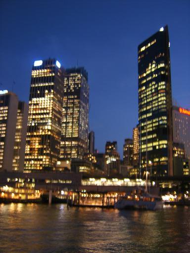
2) Circular Quay

3) Opera House with the Moon rising


Today was going to be a serious rest day with a trip to Bondi Beach. Weather was ideal beach weather being sunny all day and getting to 29C.

The journey there was interesting with first a ferry to the City Centre at Circular Quay and then a train on Sydney's Cityrail System to Bondi Junction. The Circular Quay train station is right next to the ferries and trains are double Decker's. The system is partly underground and partly overground especially in the suburbs

Bondi junction is about 3 miles from the beach so I got a bus from there. The bus station is built on top of the underground rail station. This is what I would call an integrated Transport system.

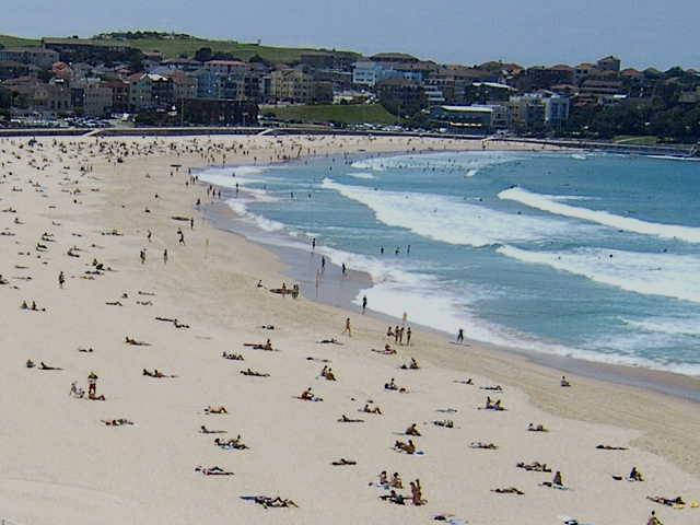
Bondi beach was as I expected a long bay of golden sands with lifeguards and lots of sunbathers and surfers. The rest of the day was given over to serious rest, sunbathing and wandering the esplanade.

I returned to Circular Quay soon after sunset for the now obligatory nightime photo shoot.

remote Posted by Edwin at 6:48 PM EADT
Updated: Friday, 25 February 2005 8:52 PM EADT
Post Comment | Permalink
Sydney, Wednesday 23 February.


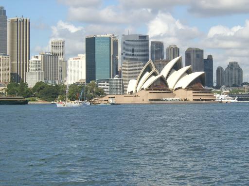
1) View of Sydney Opera House on the ferry ride from the B&B

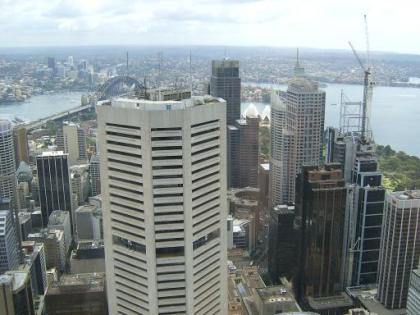
2) View from the Skytower

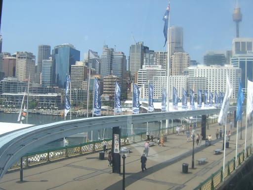
3) Darling Harbour from the Monorail

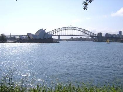
4) Sydney Opera House and Harbour Bridge

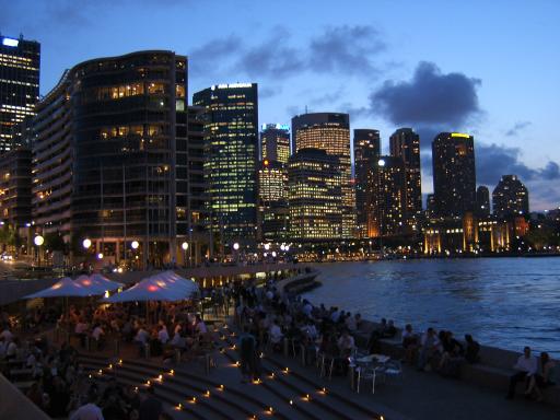
5) Circular Quay at twilight

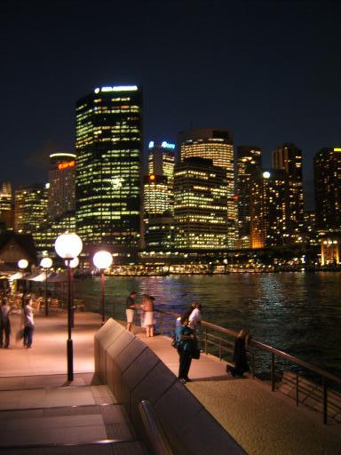
6) Circular Quay


Today was a day for exploring the City Centre, mainly on foot but with the help of ferry and Monorail.

First there was the ferry trip from the B&B to the centre with great views of the Sydney Skyline. I then explored some of the streets heading in the direction of the Skytower which at nearly 1000 ft is the tallest in the Southern Hemisphere.

I spent some time on the observation deck before taking the stairs one level down to the cafe for lunch which was certainly a more novel location than on Wednesday Rides back home. While there I replied to an email from John Maxim with my mobile internet device sending him as an attachment a picture of the view from the Tower. That makes for a pretty instant postcard.

After descending the Tower I got on the Monorail which does a loop from the City centre to nearby Darling Harbour and areas to the west of the centre. Next it was a stroll through some nearby parks with a stop for some Sunbathing and on to the Botanical Gardens. In one park there is a big colony of bats hanging from the trees and screeching.

I made my way down to Macquaires Point the location for taking the classic picture of the Opera House and the Harbour Bridge in the same field of view.

Then a walk round the Bay still in the Park to the Opera House and a good look round. Then dinner at a Harbour Side Cafe and watch the sunset. Then more evening photographs of the City to round off a very full day.

The ferry ride back to the B&B is outstanding at night. The view of tightly packed lit skyscrapers are in the centre of the small bay where the ferries dock with the Opera House on one side and the Harbour Bridge on the other side


remote Posted by Edwin at 4:52 PM EADT
Updated: Friday, 25 February 2005 8:54 PM EADT
Post Comment | Permalink
Christchurch to Sydney, Tuesday 22 February.
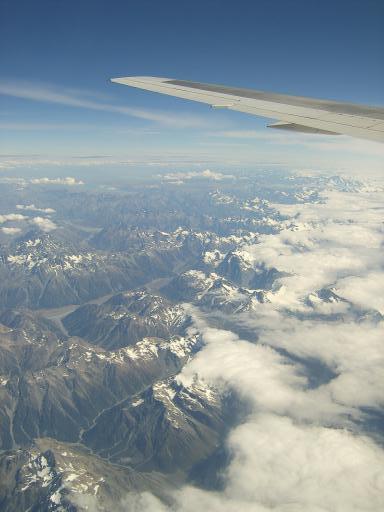
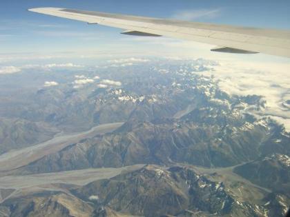
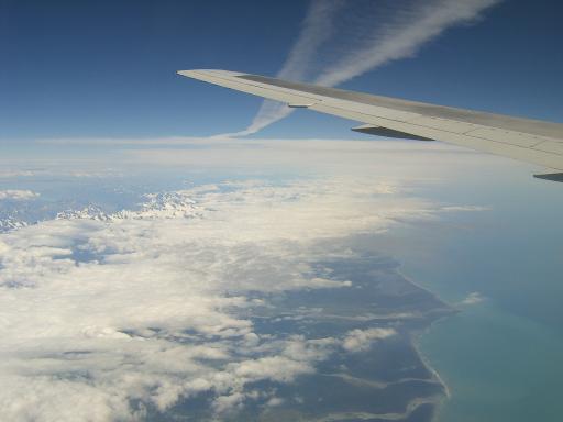
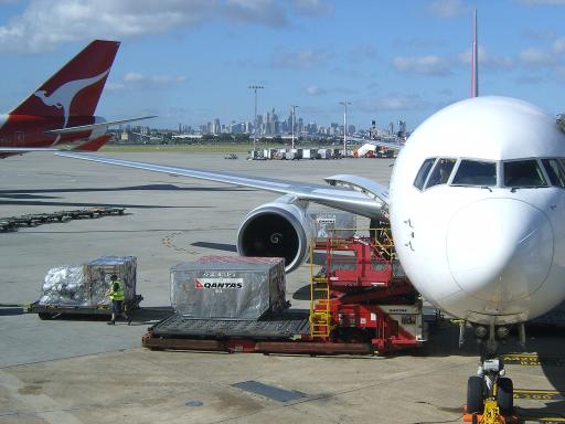
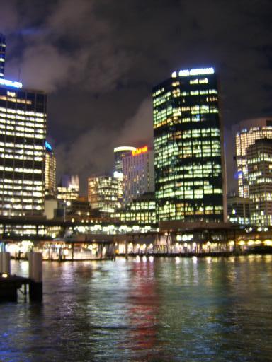
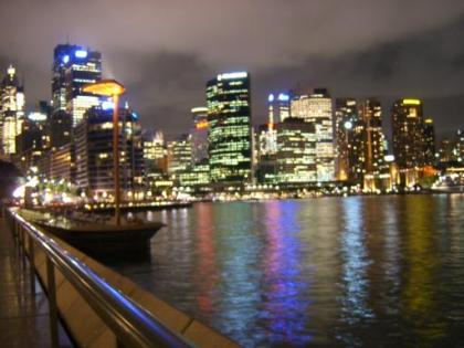


1) Flying over the Southern Alps

2) The Southern Alps

3) Clearing the West Coast

4) At Sydney Airport, City in distance

5) Night view of the City near Circular Quay

6) Night View of the City

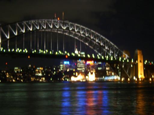
7) Sydney Harbour Bridge


Today was a great day for photographic opportunity as can be seen from the pictures above. It was also a day for packing a lot in so it was just as well that with the time change it was a 26 hour day.

With the bike packed the previous day there were a few hours spare to look round Christchurch again and do a bit of shopping.

The taxi had been pe-booked by email 5 months ago to pick me up at 12.00 and take me to the Airport but they forgot but did turn up within minutes of a reminding phone call.

At the Airport one dampner on an otherwise great day was that the checkout lady required the bike to be put on the luggage scales. She then said the bike plus my other baggage exceeded the luggage allowance and there was an excess baggage charge of 170NZ$ or about 70 pounds. Most Airlines have a special allowance for bikes or don't bother weighing them. Moral of the story is avoid flying Quantas with a bike if possible.In our case we had to because they were part of the alliance of Airlines for the Round the World Ticket we used.

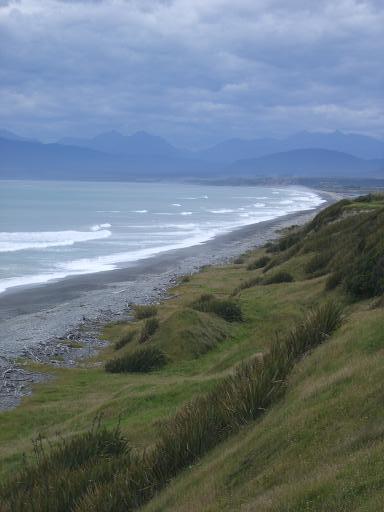
The flight over the Southern Alps was great for photography with skies clear apart from over the highest peaks near the West Coast.

The flight arrived in Sydney 10 minutes ahead of schedule and by the time I got to baggage reclaim luggage and bike were waiting for me.The bike had to be checked by customs/quarantine officers for any obnoxious soil or vegetable particles it might have picked up. This involved the box being opened and the bike checked. My other luggage was X-Rayed.

I had checked on some websites and as expected there was no problem getting the bike in a taxi with a number of Station Wagon Taxis available.

My accommodation for the next 5 nights in Sydney is a B&B called Cremorne Point Manor. This is on the north shore on the far side of the Harbour from the Centre but only a 10 minutes ferry ride to the Centre.

I got to the B&B about 6.15 but didn't want to leave the bike to the next day to sort out so got it out of the box and re-assembled.

I went a few minutes walk down the road to the ferry wharf to get the 8.15 ferry to the City. By this time it was twilight and the City's lights were coming on with a great view of the City Skyline the Opera House and Harbour Bridge.

The ferries run every 20 to 30 minutes and I had a great 10 minute ferry ride with views of the Opera House, City Skyscrapers and Harbour Bridge. When I got off I went into full photographic mode using railings and litter bins as objects to steady the camera for night shots. The moon was rising over the Opera House and scattered clouds above the City were lit up partly by moonlight and partly by the City's lights.

With all the time spent photographing and sightseeing the evening meal was a snack from the ferry terminal cafe/takeaway before another ferry ride back to the B&B.


remote Posted by Edwin at 4:29 PM EADT
Updated: Saturday, 26 February 2005 6:03 PM EADT
Post Comment | Permalink
Monday, 21 February 2005
Akaroa to Christchurch, Monday 21 February


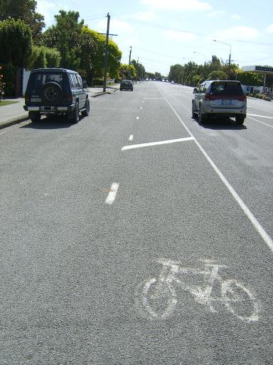
1) Cyclepath on the way into Christchurch

2) Home Lea B&B in Christchurch


Todays ride was almost a repeat in reverse of the ride out to Akaroa. However instead of riding up the main road to cross the big 1500ft pass at Hilltop I took a side road from Duvachelle to the Summit Road. 3 cars passed either way in 45 minutes of climbing. From Hilltop there was a long fast descent to Little River and an elevenses stop at a cafe

The rest of the ride was now flat and I had a Carrot Cake stop at a cafe at Taikapu near Lincoln.

Coming into Christchurch it was notable how cycle friendly it was with thought given to the cyclist in road design. There were long stretches of wide cyclepath with car parking on the left so there was no problem of cars parked on the bike lane.

I got to the B & B early at 4.00 to give plenty of time to box up the bike ready for my flight to Sydney tomorrow.

Distance for the ride was 50.9 miles with 2677ft of climb.Average grade was 8% and average speed 9.5 mph with riding time of 5 hours 14 mins

remote Posted by Edwin at 6:44 PM EADT
Updated: Monday, 21 February 2005 7:39 PM EADT
Post Comment | Permalink
Akaroa, Dolphins Cruise, Sunday 20 February.


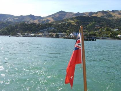
1) Leaving the Harbour

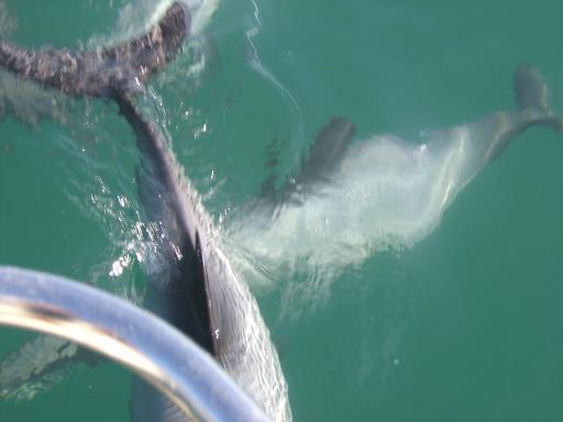
2) Dolphins swimming under the rear of the boat


Today was an off the bike rest day. With the weather still calm and sunny I decided on a morning boat cruise of Akaroa Harbour with a firm called Akaroa Dolphins. I booked this about 45 minutes before sailing and luckily they had room. As the name suggests one of the main objects of the 2 hour cruise is to spot Dolphins.

Akaroa harbour is an ideal area for the Hector Dolphin the smallest in the world together with Seals, Penguins and Cormorants.

Soon after we left the harbour the Skipper spotted some Dolphins which at several stages swam alongside and underneath the boat.

Later we spotted a penguin in the water. I know Peter will be especially interested in this as he was anxious to see one on the trip. The penguin was nervous of boats so we couldn't get very close. I got a picture with the zoom lens of my slide camera but not with the digital camera so a view will have to await the slide show.

We also saw Cormorants and seals on a trip which went beyond the harbour entrance.

The ships dog was called Hector, a scotty who went crazy when dolphins were spotted and also had a specially fitted lifejacket.

The afternoon was spent lazing around the town harbour and beach doing some sunbathing. Back to the biking tomorrow with a return ride to Christchurch.

remote Posted by Edwin at 6:34 PM EADT
Updated: Monday, 21 February 2005 6:55 PM EADT
Post Comment | Permalink
Sunday, 20 February 2005
Akaroa, Okains Bay Ride, Saturday 19 February


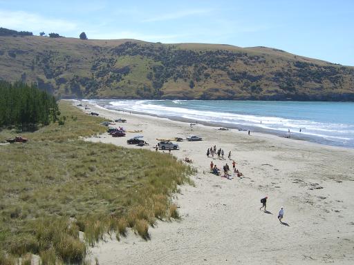
1) Okains Beach

2) Top of the very steep Long Hill Road

3) Appropiate road name near Okains Bay


Today was again bright blue skies and temperatures rising to 23C I decided to set off for a beach. This was not however going to be a lazing around sort of day as the chosen beach was on Okains bay on the Eastern side of the Peninsular with a 2000ft barrier to climb over to get there and then again to get back.

I decided not to take the super steep Long Bay Road I tackled yesterday (once was enough) so headed along the main road near the bay for 4 miles to Robinsons Bay and then up to the Summit Road on the Okains Bay Road. This was a much more sensible gradient with the bike computer reading between 6 and 12% as opposed to between 10 and 18% on Long Bay Road.

Again there were geat views as I climbed. I crossed the Summit road and headed on down at a steeper gradient followed by a long flat road to the village of Okains Bay and then the beach further on.

The beach is on a wide sheltered sandy bay which seemed popular with surfers. As the day went on more cars arrived which parked on the sand. When I left I visited a very good Maori Museum which is one of only a few houses in the village.

The return back up to the Summit Road was easy at first and then very steep with grades between 12 and 17%. I took the slightly longer route back along the Summit Road with great views and then to the top of Long Bay Road and a steep descent to the smell of brake rubber.

Distance for the day was 30.2 miles but with 4780ft of climb (nearly 3 times the climb of an average 50 mile club ride) Average grade for the day was 9% with an average speed of 8.2 and ride time of 3 hrs 36 mins.


remote Posted by Edwin at 2:09 PM EADT
Updated: Sunday, 20 February 2005 3:06 PM EADT
Post Comment | Permalink
Akaroa - Summit Road, Friday 18 February.


1) Summit Road

2) Summit Road just before descending to Duvauchelle


Today's ride was without luggage doing a loop along the Summit Road which follows the ridges created by the old Volcano and then down to the harbour road and back to Akaroa. With a high moving in weather was wall to wall sunshine and temperatures of 24C.

I climbed out of Akaroa for a few miles on the main road and then turned onto the aptly named Long Bay Road. This was basically a pig of a climb. The road climbed from sea level to 2136 ft in 3 miles. The average gradient for the climb was 10% compared with an average of 6% on most climbs. There were many sections with grades of between 12 and 18% with a maximum of 20%

The reward was in the magnificent views of the harbour below and I had to stop frequently to take pictures (catch my breath!)

At the top the road turns and runs north along the summit ridge with views down to the harbour and the ridge on the far side of it. The Summit Road does a half circuit of the harbour far below. The road generally keeps its height but with ups and downs of about 300ft

There were views down to small bays on the eastern side of the peninsula. At one point as the route looped round Duvauchelle Peak views opened up of the far off ranges of the Southern Alps north of Christchurch.

I took a byroad descending steeply to the bay near the village of Duvauchelle and then followed the main bay road back to Akaroa.

Only 26 miles ridden but 3950ft of climb (equal to twice the climbing on a standard 50 mile club ride back home) Average grade for the whole ride was 9%. Average speed was 8.5 mph with 3 hours riding time.

remote Posted by Edwin at 12:18 PM EADT
Updated: Sunday, 20 February 2005 2:35 PM EADT
Post Comment | Permalink
Friday, 18 February 2005
Akaroa, Thursday 17 February.


Akaroa Harbour with cloud trying and failing to spill over the surrounding 2000ft peaks


Today is the first of 4 clear days I have at Akaroa a small town on a bay of a large harbour/inlet which goes into the middle of the Banks Peninsular. The harbour was formed by the flooding of a former volcanic crater and is almost surrounded by 2000ft hills. The area is in considerable contrast to the great flat expanse of the Canterbury plains in all other directions.

Akaroa was originally settled by the French and has retained French street names but its current residents are very much English speaking New Zealanders. It is a pretty small quiet town though with a lot of tourists. There are a lot of choices for bike routes during my stay with some very scenic and hilly roads in the area.

Today is a proper off the bike rest day. I made use of the motels guest laundry facility, caught up on emails and wandered round the harbour. Weather was sunny with some cloud and temperatures getting up to 26C.

remote Posted by Edwin at 3:29 PM EADT
Updated: Friday, 18 February 2005 3:41 PM EADT
Post Comment | View Comments (1) | Permalink
Christchurch to Akaroa, Wednesday 16 February


1) View over Akaroa Harbour from the Hilltop Cafe at 1500ft.

2) La Rive Motel


I said goodbye to Martin who fly's to Sydney in the afternoon. I set off to stay 5 nights at Akaroa on the Banks Peninsula. This is a very hilly area to the east of Christchurch formed by volcanic action. The day was cloudy with sunny periods especially in the afternoon with temperatures up to 24C.

As with all main routes in and out of Christchurch the roads are very cycle friendly. There is the pavement and then parking bays for cars and then a wide cyclepath and then the carriageway.

I took the main route 75 to Akaroa . This is busy near Christchurch but then tails off to the level of a UK country B road. The notable feature in the morning was how flat it was. Despite skirting close to the edges of the Hills of the Banks Peninsula the road stayed pan flat with only 60 feet of climb in the 33 miles of climb to Little River.

I stopped for elevenses at a cafe near Motukarara And enjoyed a large Carrot Cake with cream. This was just about worked off as after Little River the road climbed steeply to 1500 ft. I stopped for lunch at the Hilltop Cafe with views down to Akaroa Bay.

After descending the road follows the Bay round with four 300ft climbs before Akaroa . My accommodation is at the La Rive Motel.

Distance was 50.4 miles with 2578 ft of climb. Average speed was 10.6 with riding time 4hrs 39mins

remote Posted by Edwin at 2:20 PM EADT
Updated: Friday, 18 February 2005 3:35 PM EADT
Post Comment | Permalink
Christchurch Rest Day, Tuesday 15 February


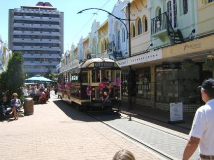
Tram on New Regent Street in Christchurch


Today was a rest from cycling but not a rest as such as we packed a lot in. Martin fly's off tomorrow to Sydney and then Cairns. I stay in New Zealand for 5 more days before flying to Sydney to stay there and in the nearby Blue Mountains for 2 weeks.

In the morning Martin packed up his bike in the box which we had posted to the B & B from Auckland. I went down to the City Centre to pick up a package I had sent from the UK to the Christchurch main post office containing maps and guides for Australia and Singapore. I used the box collected to post home maps paperwork and guides for Chile and New Zealand to lighten the load.

In the afternoon we took a ride on the City's Trams visiting New Regent Street for lunch and then the Cathedral and Cathedral Square. We also visited the City's large botanical gardens with a stop at the cafe for drinks and Carrot Cake. We then caught the no 28 bus to visit the harbour at Littleton

After the evening meal I visited an Internet Cafe to update the websit

remote Posted by Edwin at 2:14 PM EADT
Updated: Friday, 18 February 2005 3:23 PM EADT
Post Comment | Permalink
Lake Coleridge to Christchurch, Monday 14 February


Large sized Carrot Cake at Lunchstop


The day started with heavy rain and we delayed our start by half an hour to let this ease off. This was still only the second wet day in nearly 6 weeks of touring.

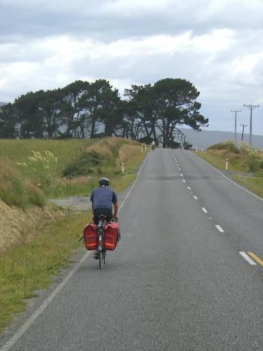
The rain eased off and stopped as we rode back down the valley of the Rakaia river. We re-joined the Inland Scenic Route 77. This was very enjoyable as the road slowly descended down a valley wth mountains to our left and our speed boosted further by a tailwind.

We stopped at a shop at Glentunnel for a snack for elevenses and then down to the plains to Darfield for lunch. I had a soup and a carrot cake. This was possibly the largest so far at about 3 times the measly portions served up in the UK for 3.50NZ$ or about one pound fifty. For one reason or another I had failed to get a carrot cake the previous 3 days so this adequately satisfied the cravings.

After lunch the waterproofs were required again as the clouds from a front coming in from the south massed. The road by now was pan flat and dead straight into Christchurch. We got away with light rain for the rest of the ride with the heavy downpour saving itself for evening.

For the evening meal we went to a pub/restaurant operating an all you can eat buffet for 19NZ$ or about 8 pounds for all courses. I was fairly restrained, only 2 main courses and 3 desserts.

Mileage for the day was 64.3 with 807ft of climb and 2066ft of descent. Average speed was 13.2 with 4hrs 47mins of riding time.

remote Posted by Edwin at 2:09 PM EADT
Updated: Friday, 18 February 2005 3:17 PM EADT
Post Comment | Permalink
Tuesday, 15 February 2005
Staveley to Coleridge, Sunday 13 February


1)Viewpoint on track above Lake Coleridge

2)Martin on the road up the valley of the River Rakaia


Today's ride was quite short at 35 miles so we had a leisurely start. Catherine and Adrian showed us round the farm including the friendly goat, tame baby Deer and the calves they were rearing.

We headed north on the Inland scenic Route 77 which runs on a generally flat route parallel to the foothills of the Southern Alps. To our left rose the peaks of Mount Somers and Mount Hutt and to our right the great flat expanse of the Canterbury Plains.

The day was bright and clear with temperatures rising to 22C.

At midday we descended to the gorge of the Rakaia River with great views from the bridge over the river. The river generally flows in braids
across a wide valley but at this point narrows between rock walls.

We took a shortcut up an unmade road to climb back up away from the river with views of the azure blue river spreading across a wide valley on the Canterbury plain. We had been unable to find any cafes on the route so we stopped at the top for snacks from our bags

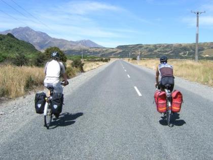
We were now headed inland up the valley of the Rakaia River into the depths of the Southern Alps towards Lake Coleridge. For the 12 miles up the valley we had a strong headwind but this did not detract from the magnificent scenery.

Lake Coleridge village is a small village situated about 400ft below the level of the Lake. We left our luggage at Lake Coleridge Lodge and headed on up the lake. This is accessed by a 3 mile long gravel road
with hairpin bends. As we climbed higher the views opened up below us of the azure blue river Rakaia with mountains rising up from the far side
of the valley.

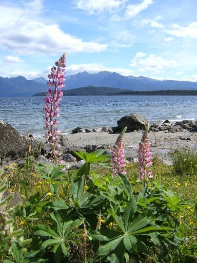
We eventually reached a viewpoint looking out over the clear blue expanse of Lake Coleridge with snow capped peaks falling to its sides in the far distance.

We rode 38.1 miles with 2112 ft of climbing.

remote Posted by Edwin at 7:32 PM EADT
Updated: Thursday, 17 February 2005 9:58 AM EADT
Post Comment | Permalink
A Ride to Middle Earth, Saturday 12 February.


1) Martin on the track to Middle Earth

2) View of the valley of the Rangitata River

3) Lunchstop

4) Mount Sunday (Edoras)


Today was one of the highlights of the trip with a ride up a dead-end road into the remote reaches of the Southern Alps. The ride was up to the spectacular braided valley of the River Rangitata and an isolated rock called Mount Sunday. This was the site of filming of parts of the Lord of the Ring films and the Castle of Edoras capital of the realm of Rohan.

After yesterdays rain the day dawned bright and sunny. We were treated to a slap up breakfast at Awaiti Farm Stay and Catherine kindly made us a packed lunch to keep us going in the remote areas of the Alps.

From Staveley we headed down the road towards Arundel! At the small village of Mount Somers we turned west up the valley of the Ashburton River. The road gradually climbed with about a car every 5 minutes.

The first 20 miles of the route from Staveley was tarred as far as the village of Hakatere (a house and 2 barns) The road then turned gravel climbing up to Lake Clearwater. The scenery became more dramatic and remote with only dry and barren mountains around us.

Eventually we came to a ridge above the valley of the Potts River flowing as a tributary into the massive expanse of the braided spreadout Rangitata River surrounded by high mountains and with snow capped peaks at the head of the valley. This viewpoint had to be our lunchstop.

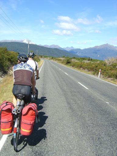
We headed on down on the track and across the Potts River on a bridge. The track headed on down alongside the Rangitata to the rocky outcrop of Mount Sunday. We stopped nearby for pictures and apart from the track we could imagine ourselves in the depths of Middle Earth.

We retraced our route on the track. By the time we got back to the tarmac at Hakatere we had ridden 29 miles on gravel tracks. On the 12 mile ride from Hakatere to Mount Somers village we were passed by only 2 cars.

We returned to Awaiti Farm Stay to a barbecue meal cooked by our host Adrian. We were entertained by stories by Catherine's brother and a neighbour who called in.

Distance for the day was 68.8 miles with 2342ft of climb at an average speed of 9.6 mph and a riding time of 7 hours 2 mins

remote Posted by Edwin at 12:06 PM EADT
Updated: Tuesday, 15 February 2005 8:08 PM EADT
Post Comment | Permalink
Ashburton to Staveley, Friday 11 February


A meal at Awaiti Farm Stay. (Picture taken the following day)


Today the weather front which brought rain to Invercargill yesterday caught up with us and brought rain to Ashburton.

Our days ride was 25 miles so we were in no rush. I had a lot to do to bring the website up to date and that took care of the morning followed by a leisurely lunch while we waited for the rain to ease off.

Eventually the rain eased from heavy to light and we set off. The ride was not especially interesting, the road being dead flat and the scenery invisible. The rain became heavier as we approached our overnight stay at Awaiti Farm Stay. Staveley is a small rural community on the Inland Scenic Route at the base of the Southern Alps and just underneath Mount Somers.

Awaiti Farm Stay was the highlight of the day and the best accommodation I have stayed at during the trip. We were made welcome as if family members and treated to hot drinks and cakes in the lounge. Our wet gear was put in the tumble dryer and we had a substantial meal with our hosts Adrian and Catherine and 4 other guests from Denmark.

We were entertained by Adrians efforts to get across to the one Dane who had limited English the workings of the farm with a mixture of English and sign language.

remote Posted by Edwin at 11:30 AM EADT
Updated: Thursday, 17 February 2005 10:03 AM EADT
Post Comment | Permalink
Invercargill to Ashburton, Thursday 10 February


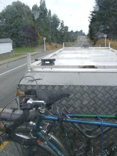
Bikes on the Atomic Shuttles Bus to Ashburton (Picture taken through rear window)


For today we were taking the bikes on Atomic Shuttle buses. We were also saying goodbye to Peter who was going to Christchurch to fly back. To deal with the 2 bikes per bus problem Peter took a bus from Invercargill to Queenstown, changed there and caught another bus to Christchurch. Martin and I got a bus to Dunedin and changed there for another bus to Ashburton about 50 miles south of Christchurch from where we will continue touring.

The morning dawned with continuous heavy rain as the weather broke. We donned waterproofs for the first time in 5 weeks of touring to ride the 1/4 mile to the Information Centre a few blocks from the Motel from which the buses left.

When we arrived the Information Centre was just opening and about 3 of the ladies were gathered round the corner searching for a Spider. As soon as we came in Martin shouts out "there it is" which brings forth a few screams and a lot of hilarity from the rest of the Staff.

The various bus trips went well and we arrived at Ashburton on time at 7.00 pm. The bus driver asked where we were headed now, a backpackers? (this is similar to a UK Youth Hostel) I said no, a Best Western. We stayed at the Best Western in Ashburton which is considerably cheaper than a UK Best Western. Cost was 100 NZ$ (about 40 pounds for the 2 of us in a 2 room suite)

Miles for the day were 3.1.

remote Posted by Edwin at 11:13 AM EADT
Updated: Thursday, 17 February 2005 10:07 AM EADT
Post Comment | Permalink
Friday, 11 February 2005
Tuatapere to Invercargill, Wednesday 9 February


1) View from lookout towards Fiordland

2) Town of Orepuki

3) On the coast road


Today was cloudy but dry and fairly humid with temperatures reaching 26C in the afternoon.

After 5 miles we reached the coast and a lookout with views back along the coast to the mountains of Fiordland and across the channel to Stewart Island in the far distance.

Cycling along the coast we started to see clumps of trees bent far over by the south west wind which normally roars up the channel of this remote part of Southland. The trees were seared white by salt.

We stopped for elevenses at a pub in the remote town of Orepuki. Some of the centre was long since deserted with the buildings looking straight out of a ghost town from the wild west.

We continued along the Coast alongside the dark and inpenatrable Longwood forest with knarled and stubby trees looking straight out of Middle Earth. We spotted a New Zealand Wood Pigeon twice the size of an ordinary pigeon perched on a branch.

We stopped for lunch at Riverton and then a flat or gently rolling ride to the South Coast city of Invercargill.

Distance for the day was 52.8 miles with 1197 ft of climb. Average speed was 10.4 and riding time 4 hrs 58 mins.

remote Posted by Edwin at 10:12 AM EADT
Updated: Friday, 11 February 2005 10:24 AM EADT
Post Comment | Permalink
Te Anau to Tuatapere, Tuesday 8 February


1) Lake Manapouri

2) Martin and Peter riding with a tail wind and no cars

3) Martin and Peter riding across the plain from Te Anau


After yesterday's rain on the minibus trip today was back to bright and clear weather with temperatures reaching 28C.

We had a good hot breakfast at our B & B and set off first alongside Lake Te Anau and then across a magnificent plain with a backdrop of the primordial mountains of Fiordland National Park.

We abruptly came down to Lake Manapouri reputed to be New Zealand's most beautiful with mountains rising up from its shores. We stopped here at a pub for an early lunch and to stock up on supplies for the rest of the days ride. Pedallers Paradise advised and this was confirmed by locals that there were no shops or cafes and few habitations for the remaining 50 miles to Tuatapere.

As we rode from Manapouri the Cheviot Hills rose to one side of us backed by the 1600 metre peaks of the Takitimu Mountains.

The road was now due south for the rest of the ride and the wind gradually increased to a strong northerly. At the same time apart from some short climbs the road was gradually downhill from the 400 metre summit of Jerico Hill to Tuatapere at 70 metres. This made for a rare ideal day of cycling as we rode along effortlessly. Peter was in the lead for a while and easily maintained a speed of 17mph. To top it all off we enjoyed an open road with an average of a car every 5 minutes.

A group of 3 Touring Cyclists going in the opposite direction seemed a little jealous as one called out "You choose the right day to be going in the right direction"

In the afternoon we took a break at the Clifden Suspension Bridge over the River Waiau at the village of Clifden.

Distance for the day was 63.4 miles with 1541 ft of climb and 2037 ft of descending. Average speed was 12.4 and riding time was 5 hours.

remote Posted by Edwin at 10:03 AM EADT
Updated: Friday, 11 February 2005 10:15 AM EADT
Post Comment | Permalink
Milford Sound, Monday 7 February


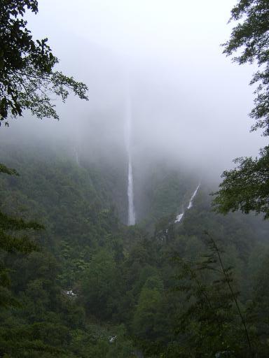
1) Humbolt Falls

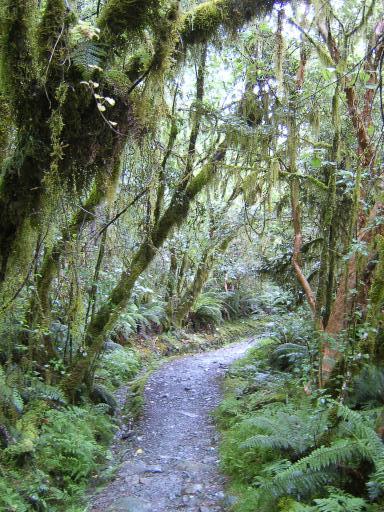
2) Rainforest Path

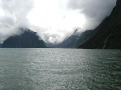
3) Milford Sound, Mitre Peak in the centre

4) Milford Sound

5) Milford Sound

6) Milford Sound


We stayed 2 nights in Te Anau and to make it feasible to do the 80 mile each way trip to Milford Sound a trip was booked on the Internet before we left with local Tour Operator Trips and Tramps. Most Coach trips to Milford Sound start from Queenstown 100 miles further away and are more rushed as a result. Also our operator kept to minibuses and 10 person groups.

Our driver and Guide Chrissy was very knowledgeable and enthusiastic about the area.

The route took us north alongside Lake Te Anau with superb views across to mountains partly shrouded in cloud.

On the route we took a diversion up the Hollingford Valley and a short walk up through rainforest to the Humbolt Falls. By this time it was raining quite heavily, our first in over a month of touring and the top of the 150ft falls was invisible in low cloud.

After traversing a mile long tunnel we headed down to Milford Sound and a 2 hour trip around the Fjord.

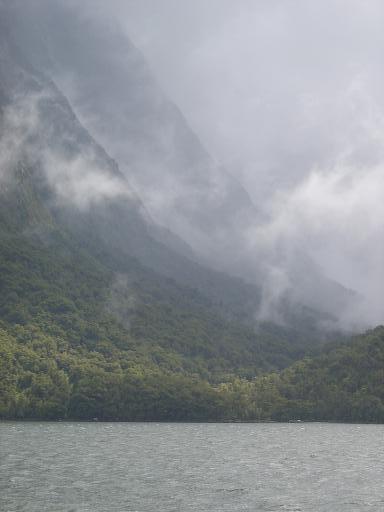
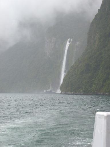
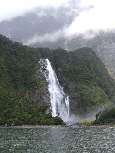
Although a clear bright day would have been preferable a rainy misty day had its advantages. One of the most dramatic features of Milford Sound is the enormous waterfalls many of which dry up a few hours after it stops raining. Further the dramatic effect of low misty clouds adds great drama to the views. See the pictures above.

remote Posted by Edwin at 9:36 AM EADT
Updated: Friday, 11 February 2005 9:58 AM EADT
Post Comment | Permalink
Thursday, 10 February 2005
Queenstown to Te Anau Sunday 6 February


1) The Kingston Flyer Steam Train

2) Lake Wakatipu


We had originally planned for today to cross the Lake on the local Steam Ferry SS Earnslaw and then a rough stuff route over the mountains. However engine problems with the 100 year old ferry and forcast wet weather for the mountains forced a change of plans.

Martin and I decided to take the road round to cover a distance of 107 miles. Peter decided this would be too far for him and booked the Atomic Shuttles bus.

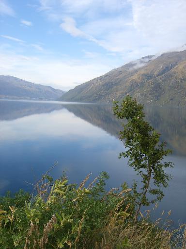
With the aid of a continental breakfast delivered by the hotel the previous night we set off at 7.30. We cycled alongside the peaks of The Remarkables Mountain Range and then alongside Lake Wakatipu as the sun gradually rose from behind the towering peaks of The Remarkables.

Our first stop was at a cafe in Kingston at the southern end of the lake after 27 miles.

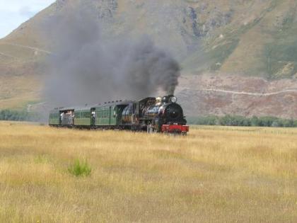
A short distance on as we cycled along a valley surrounded by remote mountains we spotted some steam in the distance. This was the Kingston Flyer a steam train running a short route for tourists. The train crosses unfenced prairie land next to the road. We put the bikes down and got pictures from within 10 yards of the track.

Our next stop was at the small village of Athol with a pleasant Cafe. We then climbed to the 398 metres Jollies Pass. The road was then down or flat on straight roads to our last stop at Mossburn and another cafe. The village had streets such as Dorset Street and Sussex Street.

At the cafe at Mossburn I had my 3rd Carrot Cake of the day. One thing about New Zealand is that food portions including cake sizes are much more generous than in the UK. Cake sizes were usually twice as big.

We gradually climbed after Mossburn to a pass at 1699ft near the village of "The Key" The day had been mainly dry with sunny periods and temperatures of 28C. We had a few spots of rain as we crossed the pass, the first in a month of touring.

We descended from the pass and gained our first glimpse of the remote primordial mountains of the Fiordland National Park. The mountains were partly shrouded in misty clouds.

We descended to Te Anau to meet up with Peter at the House of Wood B&B.

Mileage for the day was 107.3. Climbing was 2985ft and an average speed of 12.6. Riding time was 8 hrs 22 mins.

remote Posted by Edwin at 7:52 AM EADT
Updated: Thursday, 10 February 2005 7:58 AM EADT
Post Comment | Permalink
Wednesday, 9 February 2005
A ride to Arthurs Point. Saturday 5 February (2)


1) Pond near Lake Hayes, Queenstown.

2) Lake Hayes

3) Arthurs Point Road


On returning from watching Martin's Bungy Jump I had a pleasant Saturday afternoon ride taking in some quiet and very scenic lanes north of Queenstown.

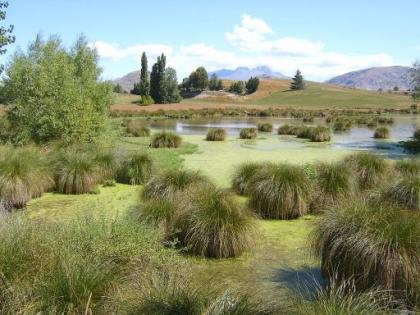
I returned at first on the main road and then turned off on a byroad alongside Lake Hayes with The Remarkables Mountain range as a backdrop.
I continued on more lanes in valleys with mountain backdrops.

Weather was hot and humid about 33C. I stopped for a welcome cold drink and ice-cream at a shop in the village of "Arthurs Point " and then a 600ft descent to Queenstown.

remote Posted by Edwin at 4:08 PM EADT
Updated: Wednesday, 9 February 2005 5:04 PM EADT

Newer | Latest | Older